Click on Map ABOVE to View Full Size or CLICK HERE to Download to your computer
Location
Canadian River Mile 508.5
Drainage Area
20,220 square miles total
16,048 square miles contributing
Project Purposes
Flood control, water supply, irrigation, recreation, fish and wildlife
Elevations, Areas and Storages
| Feature |
Elevation |
Reservoir Area
(acres)
|
Reservoir Capacity
(acre-feet)
|
Equivalent Inch
of Runoff (1)
|
| Top of Dam |
3011.0 |
|
|
|
| Maximum pool |
3004.9 |
30,470 |
2,434,200 |
2.84 |
| Top of flood control pool |
2965.0 (2) |
21,640 |
1,407,600 |
1.64 |
| Bottom of flood control pool |
2941.3 |
17,320 |
945,500 |
1.10 |
| Top of conservation pool
(ultimate)
|
2941.3 |
17,320 |
945,500 |
1.10 |
| Top of conservation pool
(initial)
|
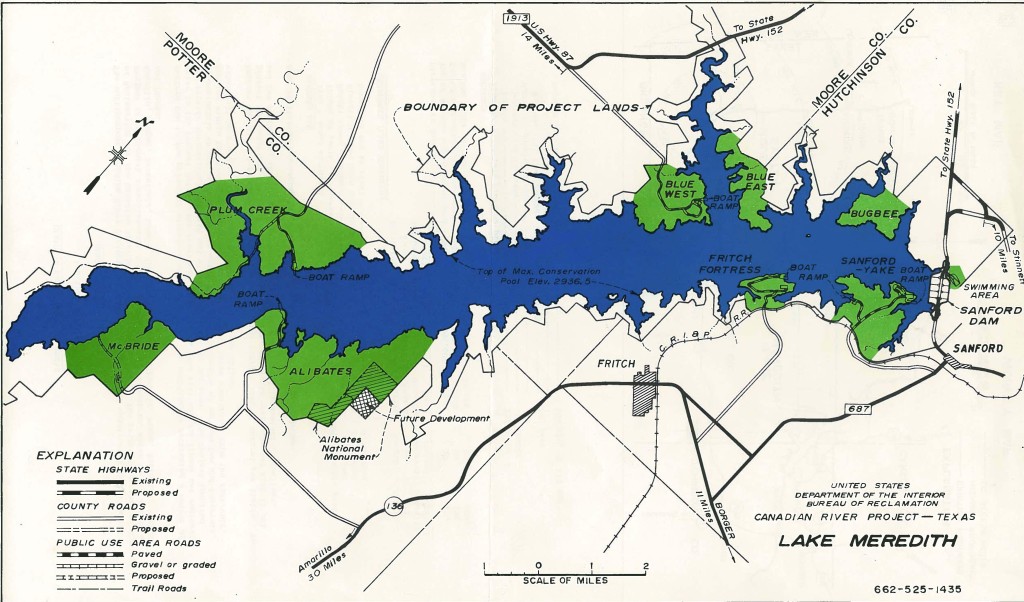
2936.5 |
16,500 |
864,400 |
1.01 |
| Top of inactive pool |
2860.0 |
4,500 |
79,200 |
0.09 |
| Top of dead pool |
2850.0 |
2,770 |
43,000 |
0.05 |
| Surcharge storage |
2965.0 – 3004.9 |
|
1,026,600 |
1.20 |
| Flood control storage |
2941.3 – 2965.0 |
|
462,100 (3) |
0.54 |
| Conservation storage
(initial)
|
2860.0 – 2941.3 |
|
866,300 (4) |
1.01 |
| Storage between top of
initial and ultimate
conservation pools
|
2936.5 – 2941.3 |
|
81,100 |
0.09 |
| Dead and inactive storage |
2813.0 – 2860.0 |
|
79,200 |
0.09 |
- Based on a contributing drainage area of 16,048 square miles
- Spillway crest
- Contains 36,300 acre-feet for sediment storage
- Contains 366,300 acre-feet for sediment storage
- The initial top of the conservation pool at elevation 2936.5 provides 500,000 acre-feet of conservation capacity permitted under the terms of the Canadian River Compact with allowance for the portion of the 50-year sediment inflow expected to deposit below the top of the conservation pool. The top of the conservation pool will be raised, as necessary, to elevation 2941.3 to preserve the conservation capacity. Any water temporarily stored between elevations 2936.5 and 2941.3 will be released by the Bureau of Reclamation, or its designated agent, through the river outlet works. Such evacuations will be at rate of 2,800 cfs, or less.